Skip to content

Invited Speaker

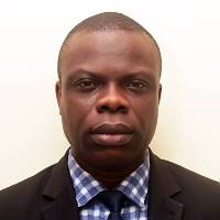
Prof. Dr. Omotosho Temidayo Victor
Covenant University, Ota, Nigeria
Presentation Title:
Recent Advances in Radio Wave Propagation and Its Application
Abstract:
In recent years, advances in Radiowave propagation and its applications have enabled spaceborne radars to provide an unprecedented 3D view of atmospheric components. Existing and planned spaceborne missions provide valuable information about the earth's climates over the oceans, land, and difficult remote areas. A careful look at their measurement capabilities will be a part of the discussion and will focus on how to best utilize recent advances in radio wave propagation such as microwave imagers, radar, and space-borne platforms and technologies, as well as addressing outstanding sensors. The first section of the presentation will focus on the observing capabilities and measurement highlights of existing spaceborne satellite missions such as Landsat, TRMM, GPM, GEOS-SAT, AIRS, and TOM satellites, etc. After that, the application of spaceborne satellites and validation with ground data in monitoring climate change will be discussed. Data can be used in agriculture, renewable energy, GIS, and modeling different types of radio communications. Finally, the potential applications and future research avenues can be explored. The purpose of this presentation is to raise awareness about existing spaceborne data, applications, and uses in scientific, engineering, and interdisciplinary research, engaging researchers, undergraduates, and postgraduate students at all levels in the new generation of Earth-observing satellites.
Short Biography:
Professor Omotosho Temidayo Victor received Ph.D. (Radio & Satellite Communication) at Covenant University, a Master of Technology in Physics (Radio & Satellite Communication), and a Bachelor of Technology (Electronics) in Physics from the Federal University of Technology Akure, Ondo State Nigeria, in 2008, 2003 and 1997 respectively. Experienced and former Dean of the College of Science and Technology and Head of the Department of Physics Covenant University Ota Ogun State Nigeria. He has 24 years of university research, teaching, and 10 years of administrative experience. Skilled in research and development, curriculum development, and mentoring of students. Proven ability to manage faculty, coordinate events, and coordinate with other departments. He is the current Head of the Applied physics research Cluster. He has a wealth of experience using in-situ, satellite, and meteorological observation data. His works have been published in high-impact journals and presented at many conferences on the effect of different types of propagation impairment on millimeter and microwave signals, Ionospheric physics, satellite remote sensing, Ozone variability, Air quality, Climatic parameters, and Climate change.

Assoc. Prof. Dr. Nurul Hazrina Idris
Geoinformatics Department, Faculty of Built Environment and Surveying, Universiti Teknologi Malaysia (UTM)
Presentation Title:
Advanced technology of satellite coastal altimetry for wave energy resource assessment in Malaysia
Abstract:
The assessment of wave energy resources over Malaysian seas using the improved satellite altimetry data is presented. Instead of the standard altimetry data, the coastal altimetry products from Jason-2/PISTACH and AltiKa/PEACHI are considered to offer a better estimation of significant wave height (SWH) over coastal oceans. In selecting the appropriate SWH, Jason-2/PISTACH from MLE4, Oce3 and Red3 retracking algorithms are examined, with respect to the limited data from Acoustic Doppler Current Profiler. The results in this study indicate that the Oce3 algorithm is the appropriate retracker. Unfortunately, it is only available for a Jason-2/PISTACH product, not for AltiKa/PEACHI. Therefore, this study uses the improved SWH from the Red3 retracker, recorded as the second appropriate retracker, in the study of wave energy resources. The Malaysian sea is dominated by low SWH (0.5-1 m) and wave period (4-5.5 s). High wave energy during the strong monsoon season can be harvested, with wave energy during a northeast monsoon ranging from 8-20 kW/m, and between 4-5 kW/m during a southwest monsoon. 10 out of 14 zones are recorded as high energy zones, producing energy storage of more than 40 MW h/m. The Malaysian sea has the potential of continuous wave energy throughout the year from the variability of SWH exceeding the minimum requirement of SWH for several wave energy converters (e.g. C5 Wave Star) to be operated.
Short biography:
Dr. Nurul Hazrina Idris is an Associate Professor of Universiti Teknologi Malaysia (UTM) in the Geoinformatics Department of Faculty of Built Environment and Surveying since 2005; a Leader of Tropical Resource Mapping Research Group, UTM; and a Fellow of the Geoscience and Digital Earth Centre (INSTeG), UTM. Since the completion of her PhD in 2014, she has held several positions. She was a Visiting Researcher/Scientist/Honorary Staff at the Climate Change Research Centre of Excellence at the University of New South Wales, Australia (2014), at the University of Newcastle (UoN) Australia (2018-2019) and recently at the Ohio State University (2023).
She has published 30 peer-reviewed papers with a cumulative impact factor of more than 10, 10 chapters in research books, and four edited research books in various national and international outlets. In support of her research, she garnered RM2 million through 29 international, national, and institutional grants. She recently published an edited book ‘Coastal Altimetry Selected Case Studies from Asian Shelf Seas’ with Elsevier Publishing.
Her research interests primarily involve marine remote sensing with foci on 1) coastal altimetry, 2) sea-level rise and climate change, 3) ocean energy resources and renewable energy, and 4) artificial intelligence and expert systems in Remote Sensing. International institutions recognize her expertise by supervising international research internships and visiting researchers inbound to UTM.
In addition to these recognitions, she was a proud recipient of the prestigious Fulbright Malaysian Scholar 2022/2023 holding a 3-month research program at the Ohio State University, United States, and the Australian Awards 2017 from the Australian Government. This award opened the opportunity for a research post-doctoral position at UoN under the Endeavour Research Fellowship for six (6) months. This opportunity was combined with a post-doctoral position at UTM (6 months), giving a total tenure of one year. With the Endeavour Research Fellowship completion, she was awarded the Endeavour Leadership Lapel Pin, which recognized her as a member of a select group of high achievers. She was also a proud recipient of the Australian Endeavour International Research Scholarship (2009-2013), which funded her PhD study at UoN; she received the 2012 Postgraduate Research Award under the Environmental Engineering and Surveying category during her PhD tenure.
Other noteworthy accomplishments include an appointment as the Chair of the Local Organizing Committee of 15th Pan Ocean Remote Sensing Conference and Tutorial Capacity Building in Malaysia (2020/2021); the Chair of Massive Open Online Course (MOOC) on Ocean Remote Sensing towards Climate Resilience (2021); she was elected to be an Exco Member of IEEE Geoscience and Remote Sensing Society Malaysia Chapter.

Mr. Midhun Mohan
Ecoresolve, San Francisco, CA, USA
Presentation Title:
The status of remote sensing-based mangrove blue carbon assessment in the Asia-Pacific
Abstract
The mangrove ecosystems provide potentially scalable and cost-effective natural climate solutions (NCS) by sequestering and storing carbon in their above- and below-ground biomass, and transferring it to soils and sediments, followed by the decomposition. The slow decomposition rates in anoxic soils in mangrove ecosystems lead to deep below-ground “blue carbon” storage (70%) with prolonged persistence. Thus, the mangrove ecosystems play a vital role in climate change mitigation. The Asia Pacific region accounts for 47% of the global mangrove cover (147, 359 km2), with an estimated 1611 Tg of biomass carbon stock. Indonesia alone accounts for 20.9% of global mangrove cover, followed by Australia (6.5%), Malaysia (4.7%), Myanmar (3.3%), Bangladesh (3.2%), and India (2.8%). This Asia Pacific region has been identified as a global hotspot of mangrove deforestation due to anthropogenic influences where the carbon sink capacities are significantly affected. A better understanding of the spatiotemporal dynamics of mangrove blue carbon is needed to formulate accurate monitoring strategies and implement informed decision-making for policy formulation and regulations for the sustainable management of mangrove ecosystems. Compared to field-based methods, remote sensing (RS) tools can efficiently quantify aboveground biomass (AGB) attributed to low cost, high accuracy and precision, and also the ability to map larger areas. Multispectral, Radar, Light Detection and Ranging (LiDAR), hyperspectral, and drone-based monitoring are proven to be suitable in the estimation of mangrove blue carbon whereas multispectral data have been extensively used in measuring mangrove blue carbon in this region. LiDAR has provided promising results with high accuracy for AGB and carbon stock compared with the other sensors. Age, species, topography, season, tides, soil type, anthropogenic influences, and vegetation structure have been identified as the main factors that determine mangrove blue carbon stocks. Major drawbacks associated with RS approaches are atmospheric correction, water penetration, water column transparency issues, limited training samples, and backscattering mechanisms of SAR. These can be overcome by employing machine learning and artificial intelligence methodologies. In summary, the quantification of mangrove blue carbon ecosystems based on RS and machine learning algorithms holds great potential in contributing to global efforts towards mitigating climate change as a NCS in the Asia Pacific.
Short biography:
Midhun "Mikey" Mohan is an entrepreneur based in San Francisco working in areas of tech-based ecosystem conservation and restoration. His ongoing research focuses on using remote sensing technologies and quantitative modeling techniques for understanding how marine ecosystems and their carbon reserves are/will be impacted by different climate change scenarios. He also has 8+ years of experience working in areas of LiDAR, UAVs, Tropical Forests, and Ecohydrology, and has co-authored 35+ peer-reviewed publications in journals such as Nature Communications and Remote Sensing of Environment.