Updates on Flooding in Bangkok
- Digital Globe releases a satellite image captured on 24 October 2011 showing flooding near Bangkok, Thailand.
- Overview of Flood Waters over Central Provinces, Thailand from UNITAR
- Google Crisis Response site
Thailand, GLIDE number: FL-2011-000135-THA
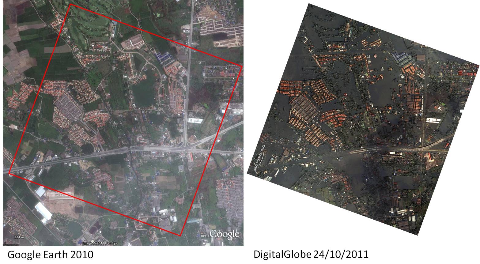
1. Digital Globe releases a satellite image captured on 24 October 2011 showing flooding near Bangkok, Thailand
Locals park their vehicles loaded with belongings on overpasses to protect them from flood waters (13.963N, 100.504E) (Image and text Courtesy of DigitalGlobe and Google Earth). In another city, photo from the ground, see The Altalntic

Bangkok: Before and After - Flood October 2011
2. Overview of Flood Waters over Central Provinces, Thailand from UNITAR
This map presents the standing flood waters over the affected Central Provinces of Thailand based on analysis of satellite data recorded 24 October 2011. Based on a recent time series comparison, there are strong indications that flood waters have strongly risen within the northern, western and eastern sections of Bangkok, and further, have not significantly changed in spatial extent north of the city over the last two weeks. The highest concentration of flooding is located within the provinces of Phara Nakhan Si Ayudhya, Nakhon Sawan, Chaitan, Pathum Thani, Nakon Pathon, Ang Thong, Lopburi, Singburi and Suphanburi. It is likely that flood waters have been systematically underestimated over highly vegetated areas along main river banks, and within built-up areas within Bangkok because of the special characteristics of the satellite data used. [This analysis has not yet been validated in the field. Please send ground feedback to UNITAR /UNOSAT.]

Source: UNITAR/UNOSAT
- New update on Oct 28, Overview of Flooding along the Chao Phraya River, Northern and Central Bangkok (as on 24 October 2011) see map
The analysis is also available in Online Map Overlay via Google Crisis Response and Geo-Pictures
3. Google Crisis Response: Thailand Floods 2011
Thailand is currently facing its worst flooding in 50 years. Flood waters have swamped more than two-thirds of the country, submerging rice fields and shutting down hundreds of factories while over 900,000 families and businesses have been impacted and hundreds of lives have been tragically lost. National relief efforts are now focused on providing essential food, clean water and shelter to displaced people and restoring damaged infrastructure to the Kingdom of Smiles.
Map showing severely affected area: Urgent help needed! Go: Larger Map