 Keynote Speakers
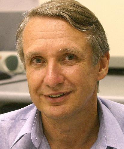
 Prof. Dr. Mohd Talib Latif
Prof. Dr. Mohd Talib Latif is a professor at the School of Environmental and Natural Resource Science, Faculty of Science and Technology, Universiti Kebangsaan Malaysia and is also a Deputy Director at Institute for Environment and Development (LESTARI, UKM). Prof. Latif completed his BSc in Chemistry and MSc in Environmental Chemistry (Air Pollution) at Universiti Kebangsaan Malaysia and obtained his PhD at the School of Environmental Science, University of East Anglia, United Kingdom. He was a head of Environmental Science Program from 2010-2013 and head of Centre for Tropical Climate Change System (IKLIM), Institute of Climate Change from July 2013 to August 2014. Prof. Latif’s main research work is on the composition of atmospheric aerosols from various backgrounds including indoor environment. He also works on the composition of gases particularly surface ozone in the atmosphere. Most recently, he has extended his research on aerosols from sea surface microlayer (SML) and the composition of volatile organic compounds (VOCs) from urban and natural sources. He has published more than 100 publications including refereed journals, book, chapter in books and proceedings.
Presentation Title: The composition of air pollutants during haze and non-haze episode in Southeast Asia
Haze episode due to biomass burning has been recognised as a major source of particulate matter in Southeast Asia region. Peat and biomass burning in Sumatra and Kalimantan contributes to high concentration of fine particulate matter (PM) in the atmosphere. Southwest monsoon bring along high amount of smoke consist of fine particulate matter to Peninsular Malaysia, as well as to Sabah and Sarawak from Sumatra and Kalimantan respectively. Strong haze episode in Southeast Asia such as in 1997 and 2015 trigged from of El Niño phenomenon and long dry periods in this region. The destruction of tropical forests and the draining of swampy, carbon- rich peatland for oil palm plantation proved to be associated with forest fires through slash and burn method resulting in haze episode. The average concentration of fine particles PM2.5 during haze episode was recorded at 61 ± 24 μgm-3 compare to annual average of 28 ± 18 μgm-3 . Results from several studies indicated that elements such as black carbon, potassium (K+ ), chloride (Cl- ), sulphate (SO42-), zinc (Zn), and silicon (Si) dominated the composition of inorganic substances in aerosols source from biomass burning. Combustion from biomass burning during haze episode also distributes the amount of carcinogenic substances such as polycyclic aromatic hydrocarbons (PAHs). Several organic molecules such as Levoglucosan (1,6-anhidro-β-D-glucopyranose) has been identified as an indicator for biomass burning.
 Prof. Dr. Colin Woodroffe
Professor Colin Woodroffe is a coastal geomorphologist in the School of Earth and Environmental Sciences at the University of Wollongong. He has a PhD and ScD from the University of Cambridge, and was a lead author on the coastal chapter in the 2007 Intergovernmental Panel on Climate Change (IPCC) Fourth Assessment report. He has studied the stratigraphy and development of coasts in Australia and New Zealand, as well as on islands in the West Indies, and Indian and Pacific Oceans. He has written a comprehensive book on Coasts, form, process and evolution, co-authored a book on The Coast of Australia, and recently co-authored another book on Quaternary Sea-level Changes.
Presentation Title: Sea-level rise and the response of tropical shorelines.
Sea-level rise threatens to exacerbate the impact of coastal hazards, requiring adaptation on the most vulnerable shorelines. Important lessons about the response of coastlines to changes of sea level can be learnt from examining past behaviour at different temporal and spatial scales. Coastal sedimentary history has been studied in order to reconstruct sea-level changes over past millennia, but it is only in recent decades that this research has been extended to interpret coastal behaviour. Stratigraphical and chronological studies which focus on the elevation of the sea surface in the past can also provide insights into how coastal landforms have behaved. If the present is the key to the past, then the past, seen from the context of the present, can be a guide to the future. Relative sea-level change over the past few millennia has varied geographically, and a single ‘eustatic’ trend has proved elusive. Similarly observed and anticipated future sea-level changes will also vary spatially. Different coasts will respond differently and models of coastal change need to be developed to replace simplistic heuristics of coastal response, such as the Bruun rule. Tropical shorelines that are particularly at risk include coastal plains and low-lying sandy islands. Examples of these from within the Indo-Pacific region will be discussed, indicating how observations and monitoring from one location in the region may be relevant to similar shorelines elsewhere.
 Associate Prof. Dr. Wayan Suparta
Wayan Suparta received his Diploma and BSc degrees in Physics from the Universitas Sanata Dharma (USD), Yogyakarta, and MSc degree in Semiconductor electronics (Physics) from the Institut Teknologi Bandung (ITB), Indonesia. He received his PhD in Electrical, Electronic and Systems Engineering (major in Communication Engineering), Faculty of Engineering, Universiti Kebangsaan Malaysia (UKM). After one-year post doctorate (2007-2008) at the Institute of Space Science (ANGKASA), UKM for Polar remote sensing, he appointed as a senior lecturer at ANGKASA (2008-2012) and from 2012 until now is working as an associate professor at the Space Science Centre (ANGKASA), Institute of Climate Change, UKM. He has teaching experience in school and university (before to UKM) and research development over 20 years. His research interest includes satellite remote sensing application for space weather and climate studies, natural disasters, solar-terrestrial physics, modeling of satellite disturbances and artificial neural network applications. He has more than 100 publications in the international journal and proceeding indexed by SCOPUS and ISI WoS; supervising Masters and PhD students, which mostly on aspects related to the GPS applications and Geophysics. He is a member of the National Antarctic Program in Malaysian Antarctic Research Programme (MARP), International Association of Computer Science and Information Technology (IACSIT), Institute of Electrical and Electronics Engineers (IEEE), senior members of Asia-Pacific Chemical, Biological & Environmental Engineering Society (APCBEES), Institution of Geospatial and Remote Sensing Malaysia (IGRSM), and the board of Asian Council of Science Editors (ASCE). He was also appointed as a national member of Malaysia task force for weather extremes and disaster (2013-Now).
Presentation Title: GPS TroWav and ANFIS Model to Support the Weather Forecasting.
GPS Tropospheric Water Vapor (TroWav) is a stand-alone program to compute atmospheric precipitable water vapor (PWV) based on the concept of GPS meteorology. The tool developed using MatlabTM was capable of computing satellite elevation angle, Zenith Tropospheric Delay (ZTD), Zenith Hydrostatic Delay (ZHD), Zenith Wet Delay (ZWD) and mapping function. These parameters are key components which influence the accuracy of weather forecasts. The tool now is capable compared with the current progress of PWV estimated from adaptive neuro-fuzzy inference system (ANFIS) technique. This soft computing technique has been tested with other models such as multi-layer perceptron (MLP), Elman neural networks, and processed GPS data from NASA to produce an accurate estimation of PWV and surface meteorological data from the Southeast Asia. These results suggest that the ANFIS model is complementary of GPS TroWav in estimating the accuracy of PWV with cost-effective, continuous, and potentially used for weather and climate applications. This talk will address the determination of PWV from GPS as a key driving force behind the atmospheric events. Some applications of GPS TroWav and ANFIS model for meteorology will be highlighted in this presentation.
Organized by

In cooperation with